![]()
![]()
![]()
![]()
![]()
![]()
![]()
Chile - Map and Statistics

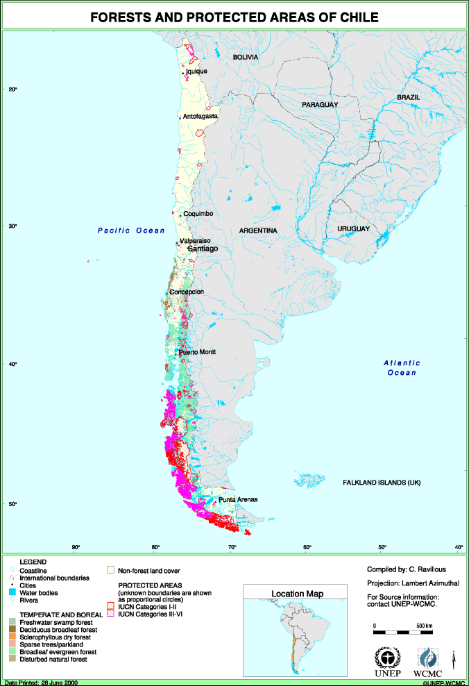
| CHILE STATISTICS | ||||||||||
| Land area: 748,800 km2 | Area of forest: 145,500.0 km2 | % Land area forested: 19.4 | ||||||||
| Forest Type | Area Protected (km2) in IUCN Categories I-VI: | Total Forest (km2) | Total Protected (km2) | % Protected | ||||||
| Ia | Ib | II | III | IV | V | VI | ||||
| Temperate and Boreal | ||||||||||
| 4 Broadleaf evergreen forest | 21547.0 | 26.6 | 17333.6 | 27.8 | 135625.0 | 38935.0 | 28.7 | |||
| 5 Deciduous broadleaf forest | 19.8 | 3.3 | 4825.8 | 23.1 | 0.5 | |||||
| 6 Freshwater swamp forest | 7.8 | 0.0 | 0.0 | |||||||
| 7 Sclerophyllous dry forest | 4.5 | 4.2 | 115.5 | 8.7 | 7.5 | |||||
| 8 Disturbed natural forest | 120.4 | 63.3 | 2365.0 | 183.7 | 7.8 | |||||
| 9 Sparse trees and parkland | 1.0 | 15.1 | 2561.0 | 16.1 | 0.6 | |||||
| Total | 0.0 | 0.0 | 21692.7 | 26.6 | 17419.5 | 0.0 | 27.8 | 145500.0 | 39166.7 | 26.9 |
For help with this web site contact:
|
Forest Programme |
Information Enquiries |